The tide decides when anyone leaves piece 3 of 5
Ilha de Moçambique, half stone and half reed
The old Portuguese capital is a World Heritage site that is two towns on one small island, built from entirely different materials.
- Stone town (cidade de pedra e cal)
- northern end; coral-stone and lime-mortar architecture, Portuguese colonial and earlier Swahili origin
- Macuti town
- southern end; mangrove pole frames and coconut palm thatch roofing; where the majority population lived during the colonial period
- Macuti
- local term (Swahili-derived) for coconut palm thatch used as roofing material
The island, the bridge, and what arrives first
Ilha de Moçambique sits roughly four kilometres off the coast of Nampula Province, connected to the mainland by a single-lane bridge built in the 1960s — long enough, at about three and a half kilometres, that you cross open water on both sides before the island resolves itself ahead of you. What arrives first is not the fort but the density: the island is small, perhaps three kilometres end to end and nowhere wider than five hundred metres, and it carries within that area a layered settlement that has been continuously inhabited for well over a millennium.
The island gave the country its name. Portuguese traders and later colonisers used Ilha de Moçambique — variously spelled across centuries of documents — as their primary East African base from the early sixteenth century until 1898, when the colonial capital was relocated south to Lourenço Marques, the city now called Maputo. That four-century tenure left a density of built fabric that has few equivalents on the East African coast: churches, chapels, a hospital, a palace, administrative buildings, and the great coral-stone fort all pressed onto this flat, sea-level sliver. In 1991, UNESCO inscribed the island on the World Heritage List, recognising what the citation describes as an outstanding example of a type of construction illustrating a significant stage in human history.
Stone town and macuti town
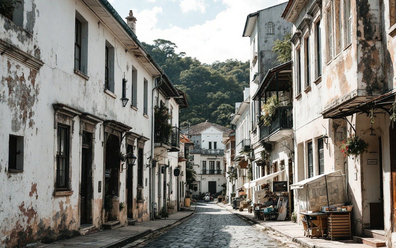
The governing fact about Ilha de Moçambique is that it is not one town but two, distinguished absolutely by the materials from which they are built. The northern end is the stone town — cidade de pedra e cal, city of stone and lime — where the Portuguese-period architecture stands: coral rag and lime mortar, thick walls, arched doorways, deep-set windows designed to catch the south-east wind and exclude the sun. The southern end is the macuti town, built from organic materials: mangrove pole frames, coconut palm thatch (macuti is the Swahili-derived local word for this roofing), and compressed earthen floors. The two towns stand on the same island, share the same lanes, and are inhabited by the same contemporary community, but they were built for different populations under the colonial system and they age differently — stone town slowly, macuti town in a single rainy season if maintenance slips.
The stone town's centrepiece is the Fort of São Sebastião, begun around 1558 and substantially complete by the early seventeenth century. It is built entirely of coral stone quarried locally, cemented with lime produced by burning the same coral, and it is among the oldest complete European fortifications in sub-Saharan Africa. The walls are massive — several metres thick in places — designed to resist cannon shot and to function in the heat. Inside, a small chapel of Nossa Senhora de Baluarte, which predates the fort itself and dates to around 1522, is considered one of the oldest European buildings still standing in the Southern Hemisphere. Whether that specific superlative survives scrutiny depends on definitions, but the building's antiquity is not in doubt: the fabric is original and the date is documented.
The governing fact about Ilha de Moçambique is that it is not one town but two, distinguished absolutely by the materials from which they are built.
The Palace of São Paulo, built in stages from the early seventeenth century onward and used as the Governor's residence until the capital moved south, now functions as a museum. Its rooms hold furniture, Sino-Portuguese porcelain, religious objects, and navigational instruments that trace the island's role in the Indian Ocean trade network — a network that connected it to Goa, Hormuz, Macao, and Mozambique's own interior long before European contact formalised those routes. The Portuguese did not invent this island's importance; they found an existing Swahili trading settlement and built on top of it.
Chronology
- c. 1522Chapel of Nossa Senhora de Baluarte constructed; among the oldest European buildings surviving in the Southern Hemisphere
- c. 1558Construction of Fort of São Sebastião begins
- Early 1600sFort substantially complete
- 1898Colonial capital relocated south to Lourenço Marques (now Maputo)
- 1991UNESCO World Heritage inscription
Layers and populations
What makes the island genuinely complex, and genuinely difficult to categorise, is that the built environment is not a Portuguese monument with local people living near it. It is a document of multiple centuries of layered occupation, and the people living in it now are not peripheral to that document — they are continuous with it. The macuti town is not a later addition or a suburb; it was part of the island's inhabited fabric throughout the colonial period, where the majority African and Swahili populations lived. The coral-stone buildings of the north end were largely elite and institutional. This distinction is written into the materials as clearly as into any archive.
That material difference creates a conservation problem with no clean solution. The stone buildings deteriorate slowly and expensively; they need skilled lime-mortar masons, sourced timber, and significant capital to maintain. The macuti buildings deteriorate quickly and cheaply, if local materials remain accessible and the skills survive — but both conditions are now under pressure. Mangrove harvesting is regulated across much of the Mozambican coast, and the generation with deep knowledge of macuti construction is not young. The Aga Khan Trust for Culture has worked on the island's built fabric since the 1990s, focusing on structural stabilisation and the training of local craftspeople in traditional techniques, with results that are visible in the stone town particularly but incomplete throughout.
What a day on the island is
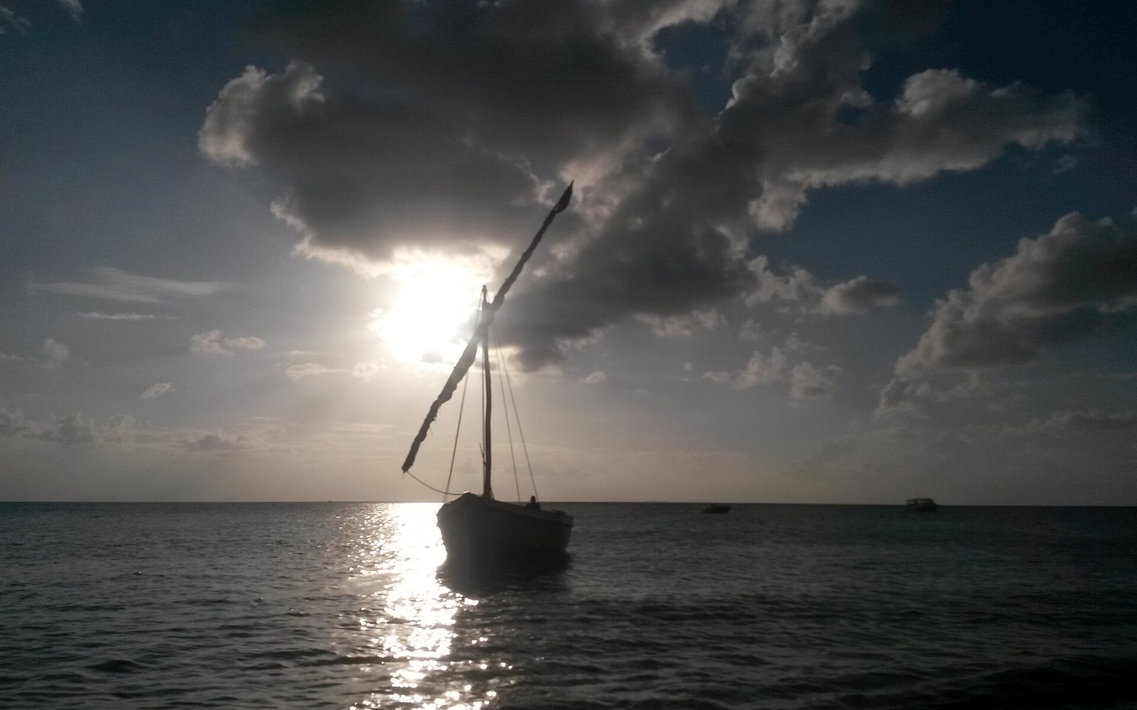
The island has one road running its spine, and the pace on it is foot and bicycle. Fishermen work from the shore on both sides; the dhow traffic that once made this harbour one of the most significant on the East African coast is now small-scale — local fishing craft with lateen sails working the channel between the island and the mainland, and occasional vessels crossing to the Quirimbas. The light in the middle of the day is very flat and very bright; the coral and whitewash together push it back at you. Late afternoon is when the island's texture becomes legible — the shadows inside the deep window reveals, the pattern of repairs in a wall where different decades of lime have dried to slightly different colours, the way the macuti roofline of the southern town reads against the water.
There is a Catholic church still in use, a mosque still in use, and a Hindu temple that is maintained. The island's population is in the several thousands; its languages are Makua, Portuguese, Swahili, and various combinations thereof. The fort's museum is small and underlit, which means you have to stand close to the objects — and the objects, in that proximity, turn out to be extraordinary: navigational astrolabes, model dhows built with the same joinery techniques as the working originals, fragments of Chinese porcelain recovered from the seabed of the channel.
This distinction is written into the materials as clearly as into any archive.
Ilha de Moçambique is not difficult to understand. One small island, one long bridge, two kinds of building, five centuries of continuous use. The difficulty is not conceptual — it is the difficulty of looking at something that dense and knowing where to begin.